Sources: Llewellyn (2020), NNTT (2021d); map projection: Australian Albers GDA94 (ICSM n.d.)

We recognise Aboriginal and Torres Strait Islanders as the sovereign Traditional Owners of Australia and thank them for their stewardship of this Country, its lands, waters and skies. We respectfully acknowledge their culture and customary practices, and pay respect to their Ancestors, Elders and future leaders.
For the first time, the State of the Environment report includes a strong Indigenous narrative across all 12 thematic chapters, a narrative crafted through recognising the leadership, collaboration and authorship of Indigenous Australians who continue their connection as Traditional Owners to their lands, waters and skies.
Click to view the State of the Environment report
On 28 March 2025 the government assumed a Caretaker role. Information on websites maintained by the Department of Climate Change, Energy, the Environment and Water will be published in accordance with the Guidance on Caretaker Conventions until after the conclusion of the caretaker period.
Due to technical issues, graphs, maps and tables are currently not displaying within the main content, however, are available via the chapter resources navigation bar. We are working on a solution to resolve the issue.
Sources: Llewellyn (2020), NNTT (2021d); map projection: Australian Albers GDA94 (ICSM n.d.)

Photos: Indigenous Land and Sea Corporation

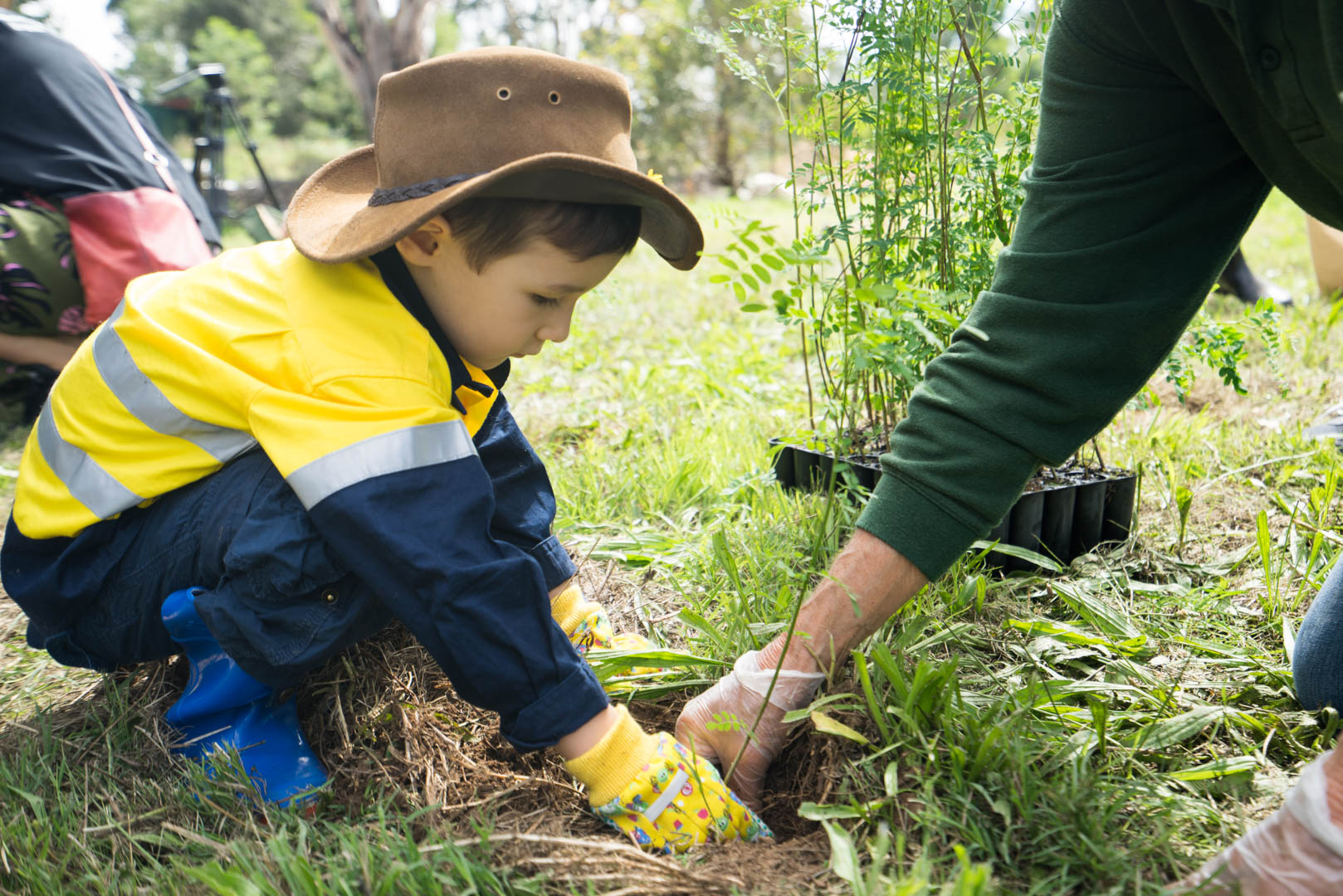
Note: Staff from online furniture business Koala at a tree planting event at Cook Park in Ruse. The event included a live cross on the Today show to promote Koala’s support of WWF-Australia’s Towards Two Billion Trees campaign.
Photo: © WWF-Australia / Paul Fahy

Note: The partnership will explore the potential for careful revegetation informed by fire ecology to create ‘green firebreaks’ that measurably reduce bushfire risk and improve resilience.
Photo: © WWF-Australia / Leonie Sii

Photo: James Walsh, ACIAR

Photos: NQ Dry Tropics and Queensland Government Landholders Driving Change Program
Source: Figure 67 in Bartley et al. (2020). Used with permission.

Note: Automated classification procedures based on fine-resolution digital elevation models are now providing these assessments in priority areas of Great Barrier Reef catchments.
Source: Figure 7 in Walker et al. (2020) of a cleared area on sodic soils (Goodnight Scrub, 25°14′S, 151°53′E).

Photo: Scott Wilkinson, CSIRO

Note: Large gullies can individually supply considerable fine sediment to river systems and the Great Barrier Reef lagoon. Compared with an adjacent untreated gully, sediment concentrations declined by more than 90% in the following years.
Photo: Damon Telfer, Fruition Environmental Pty Ltd, 2021

Note: Work was supported by the Australian Government’s Reef Trust.
Photo: Scott Wilkinson, CSIRO